


Progress Brings The Need For Transportation: The Lowcountry Bridges
Posted by Bill True on Sunday, August 19th, 2018 at 7:03pm.

As the economic foundation of the Lowcountry flowed from farming to lumber and as that demand for lumber spread further and further away from the Hilton Head region, the need for dependable transportation of product became uppermost in the plans of the local industry leaders.
This was going to be a challenge!
In most circumstances the creation of a transportation grid and employing the most appropriate methods of transportation is a fairly straight forward engineering project.
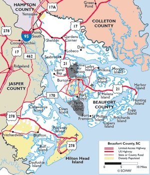
However, given the opportunity to look at a map of Beaufort County South Carolina, heart of the Lowcountry, it becomes obvious the extent of the hurdles these early planners had to face.
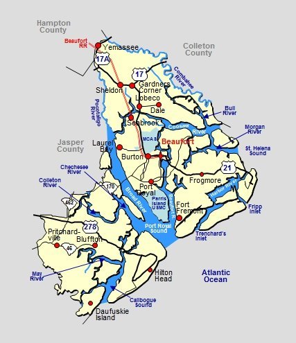 Beaufort County is comprised of several parcels of land separated by more than a dozen bodies of water:
- Beaufort River
- Bull River
- Chechessee River
- Combahee River
- Harbor River
- Morgan River
- Pocotaligo River
- Broad River
- Calibogue Sound
- Colleton River
- Coosaw River
- May River
- Port Royal Sound
- St. Helens Sound
I have left off a few inlets, but I think you get the picture.
Creating a transportation grid around and out of Beaufort County to accommodate the growing need to move people and products, was about bridges and watercraft.
Watercraft Was The Key To Early Shipping
 In the late nineteenth century, the population was relatively small (34,119 in 1890) - less than twenty percent of today.
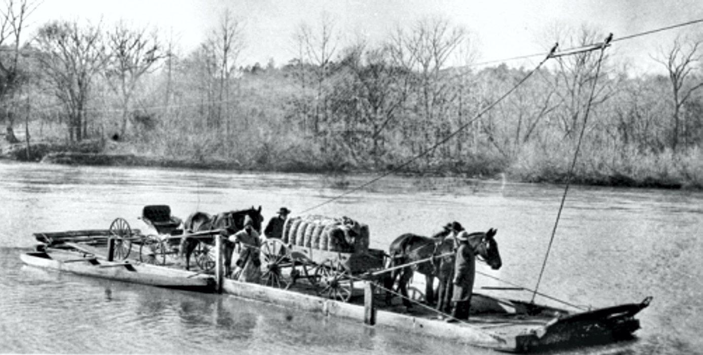
So, the movement of people was not yet a pressing issue, but the movement of product was beginning to become a serious concern for the business leaders of the county. Up until 1880, transportation routes included part of the journey on the water, not above it.
The movement of bales of rice from the dozens of rice plantations dotting the Lowcountry from say, Bluffton to Charleston, called for the loading of the bales onto a horse drawn wagon, travelling over a dirt road to the first crossing of a body of water. Boarding a barge or cable ferry (see photo) either with your land transportation, or, more labor and time consuming, transferring the rice bales to the barge and once on the other side, transferring them onto other ground transportation for the next, on land, part of the journey.
 The map of Beaufort County above can give you an inkling of the number of times that scenario would be repeated.
As the production of product became greater and more diverse, the markets became more demanding of timely deliveries, particularly for items like vegetables and shellfish.
A Need For Bridges
The business leaders got together and said, “Time to build bridges”.
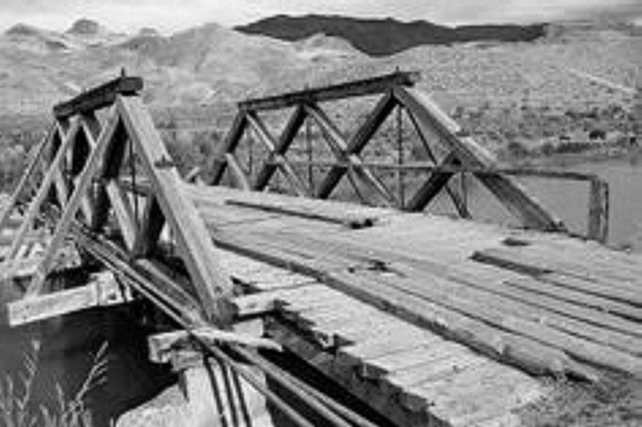
So, routes were mapped, and the most traveled crossings selected to construct bridges across. The resource most available to the engineers and bridge builders was wood. There was plenty of it in the Lowcountry. So, bridges were built across those crossings that were well traveled and that the technology of wooden bridge building was advanced enough to traverse the span.
Although, to our romantic eye of today, these essential structures are aesthetically attractive, their useable life and stress bearing capabilities were both limited.
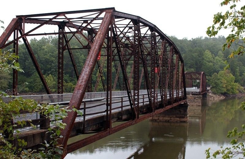
As the primary industry of the Lowcountry shifted from agriculture to lumber, new bridge building technology and the need for the water crossings to handle heavy loads and survive, merged. Steel was introduced augmented by lumber.
 The trip from Palmetto Bluff to points north became less time and manpower consuming because more of the crossings could be bridged.
The Beginnings of Today's Lowcountry
The Second World War brought about two major changes that would catapult Lowcountry transportation into the beginnings of what exists today
The first of those changes was the demand for lumber for both the building and the paper manufacturing industries.
The second most significant change came in bridge building technologies developed during and immediately after the war.
Demand for lumber products made it a most attractive investment for Lowcountry entrepreneurs to join together to buy up land and convert it to rapid developing and replenishing forests of Southern Pine. But those waterways were still there, and they were everywhere.
Then a pivotal endeavor by a group, launched the venture that would lead to seventy-years of change and advancement in everything about the Lowcountry, but particularly transportation.
Connecting Hilton Head Island to the Lowcountry Mainland
 In 1949 a group of lumber associates from Hinesville, Georgia, bought a total of 20,000 acres of pine forest on Hilton Head's southern end for an average of nearly $60 an acre. They formed The Hilton Head Company to handle the timber operation. The associates were Gen. Joseph B. Fraser, Fred C. Hack, Olin T. McIntosh, and C.C. Stebbins.
The economic impact that this enterprise produced for Beaufort County led to the first major bridge connecting Hilton Head Island with the South Carolina mainland.
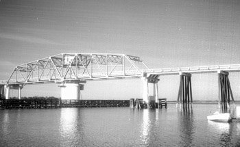
In 1956 the James F. Byrnes Bridge, a two-lane toll swing bridge, was constructed at a cost of $1.5 million. This opened the island to automobile traffic to and from the mainland.
In that same year Charles E. Fraser bought his father out of the Hilton Head company and with the 5,200 acres of Hilton Head acquired in that transaction, commenced the first major step of the next phase of the Lowcountry’s economic development, Sea Pines Plantation.
 That development ultimately encompassed more than 135,000 acres and was the catalyst to turning Hilton Head into the tourism and retirement destination it is today.
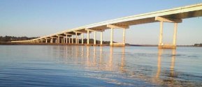
To accommodate the transportation needs of that part of the Lowcountry, in 1982 - A four-lane bridge was built to replace the two-lane swing-bridge to the island. The island's full-time population was 12,500. More than 500,000 visitors came to Hilton Head in 1982.
The improvement in transportation in the Lowcountry continues to march forward. The lead photo in this piece is The Broad River Bridge (also known as the Edward Burton Rogers Bridge), opened in 2004.
The old bridge across the Broad River was removed for two-thirds of its span leaving one-third coming off the northern shore. This brilliant use of an existing landmark as a fully restored fishing pier with fishing stations and picnic tables is a source of healthy family enjoyment to Beaufort County residents all year.
In closing I leave a view of Beaufort County transportation facilities in 2018, courtesy of the South Carolina Department of Transportation.
-Bill True